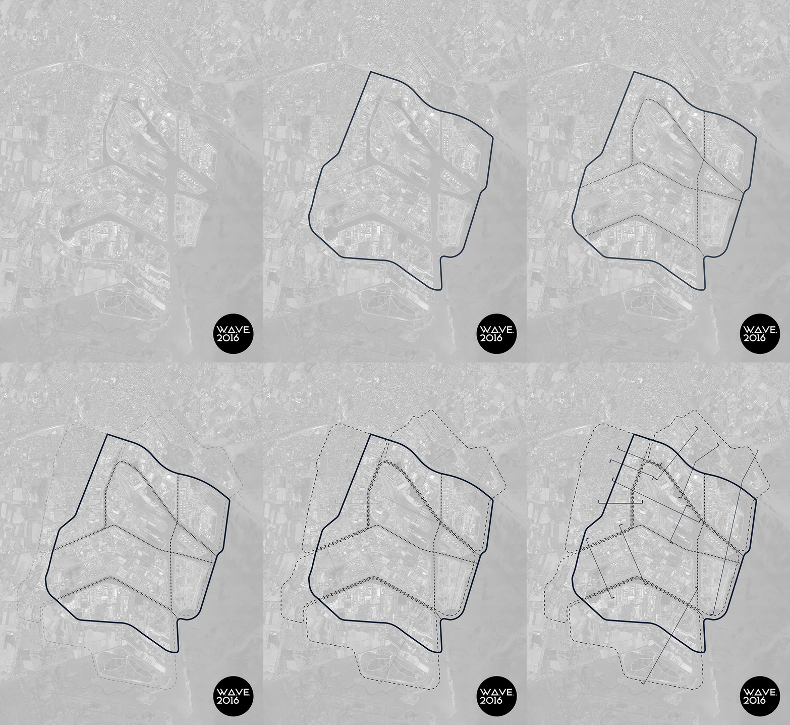
Since its foundation, during about one century, the Marghera industrial hub has undergone a process of detachment from the surrounding territory, both towards the Venetian hinterland on which it stands, consisting of a towns belt, and the overlooking lagoon system, composed of the historic city centre of Venice, the islands and the lagoon.
This process has been partially generated by the construction of the huge infrastructure system which surrounds and supports Porto Marghera: the northern infrastructural stripe of Via della Libertà and the railway running parallel to Venice, delimits Marghera area separating it from the green areas of S. Giuliano Park and Forte Marghera, as well as from the city of Mestre; here, at the opposite side of VEGA Scientific Park of Marghera, the zone close to the railway has been recently regenerated thanks to the establishment of the University Campus of Via Torino.
On the eastern side the axis of Via Fratelli Bandiera sharply sunders Marghera Garden City, built in the 20’s as factory worker’s residential area, from the industrial area which, both dimensionally and for construction technique stands out from the rest of the industrial hub, facing the residential surrounding context.
At the same time, the artificial channels system, with the high docks’ piers and, most of all, with the soil waterproofing works along the banks – required to contain polluting agents – complicates the relation between Porto Marghera and water.
Instead, at the south-east border, Marghera is defined by the Naviglio Brenta river, also called Brenta Vecchia, that flows into the lagoon at Fusina, which is a really fragile area, the last remaining shred of natural edge.
Moreover, Marghera is organized in morphological and functional enclosures which represent another delimitation system, almost exclusively proprieties of the main actors operating in the present days, such as the Port Authority and the large and small industries.
Today, as a result of the progressive abandonment of certain areas of the industrial port, follows the partial loss of meaning of the infrastructural support and some of these enclosures, which need to be retought and redisegned as connecting elements rather than splitting elements.
The challenge of W.A.Ve 2016 is to work on borders as a possible redevelopment strategy, at the architectural, urban and territorial scale; Porto Marghera can be regenerated only if it will be placed inside the Metropolitan City of Venice as a connection joint between the historical city centre of Venice and the surrounding territory.
Nel corso dei cento anni dalla sua fondazione, il polo industriale di Marghera ha subito un processo di separazione dal territorio circostante, sia rispetto all’entroterra veneziano su cui sorge, composto da una cintura di comuni, sia rispetto al sistema lagunare su cui si affaccia, composto dal centro storico di Venezia, le isole e la gronda lagunare.
Tale processo è stato in parte generato dalla costruzione del grande sistema infrastrutturale che circonda e supporta Porto Marghera: a nord la fascia infrastrutturale costituita da via della Libertà e la linea ferroviaria che corrono in parallelo verso Venezia, delimitando e separando Marghera dalle aree verdi di parco S. Giuliano e Forte Marghera, nonché dalla città di Mestre; qui, proprio in corrispondenza del Parco scientifico del VEGA di Marghera, la zona adiacente alla ferrovia è stata recentemente riqualificata tramite il campus universitario di via Torino.
A est l’asse di via Fratelli Bandiera separa in maniera netta la Città Giardino di Marghera, sorta negli anni ’20 come area residenziale per gli operai, da una zona industriale che, sia a livello dimensionale che per tecnica costruttiva, si distingue dal resto del polo industriale confrontandosi con il tessuto residenziale circostante.
Al contempo, il sistema dei canali artificiali, con le alte banchine dei docks ma ancor più con le opere di impermeabilizzazione del suolo lungo gli argini – necessarie per il trattenimento degli agenti inquinanti – ha complicato il rapporto tra Porto Marghera e l’acqua.
A sud-est Marghera è invece delimitata dal Naviglio del Brenta, o Brenta Vecchia, che sfocia a Fusina sulla gronda lagunare e che costituisce un’area di forte fragilità, ultimo brandello rimasto di bordo naturale.
Marghera è altresì organizzata in recinti – morfologici e funzionali – che costituiscono un altro sistema di delimitazione ad appannaggio quasi esclusivo dei principali attori che agiscono nello scenario attuale come l’Autorità Portuale e le grandi e piccoli industrie.
Oggi, alla progressiva dismissione di alcune aree del porto industriale, consegue la parziale perdita di significato del supporto infrastrutturale e di alcuni di questi recinti, che necessitano di essere ripensati e riprogettati come elementi di connessione anziché di separazione.
La sfida di W.A.Ve 2016 è quella di lavorare sui margini come strategia di riqualificazione possibile non solo alla scala architettonica ma anche a quella urbana e territoriale; Porto Marghera può essere riattivato infatti solo se ricollocato all’interno della Città metropolitana di Venezia come snodo di connessione tra il centro storico dei Venezia e il territorio circostante.
